Skip to content
Tag & Tether

Head to head · Tracker Comparisons

GPS trackers vs satellite messengers for hiking

This is the one category where the no-subscription answer is the wrong answer, and we would rather say so than sell you a tracker that goes quiet in a canyon.

By Mike M.Last updated

#ad — we earn a commission if you buy through the links on this page, at no cost to you. It never changes what we recommend, and the structural reason it cannot is that we recommend the no-subscription devices, which pay the least. Full disclosure.


If the question is “how do people find me if something goes wrong on a hike”, the answer is a satellite messenger and not a tracker. The Garmin inReach Mini 2 is the reference: Garmin states global two-way messaging beyond the limits of cellular coverage, weeks of battery on a charge, and interactive SOS messages with your coordinates going to a 24/7-staffed response center. Garmin also states plainly that an active plan is required — and this is the one page on this site where we tell you to pay it. If you only need to know where you are, a handheld GPS does that with no subscription at all. If the thing you are protecting is gear rather than a person, a no-fee tag covers trailheads and towns.

We spend most of this site arguing that monthly fees are usually avoidable, so it is worth being direct about why this is the exception. Everything else we recommend is solving a property problem: where is my car, my dog, my suitcase. A messenger is solving a communications problem in places where no network exists, and satellites are expensive to operate. There is no clever no-fee workaround for an SOS from a canyon. Anyone selling you one is selling you a cellular tracker with optimistic marketing.

Four devices, four completely different jobs

A satellite messenger. Sends and receives text over a satellite network from anywhere with a view of the sky, shares your position with family at home, and triggers an SOS to a coordination center. Needs an active plan. This is the only device here that works where there is no cell coverage at all.

A cellular GPS tracker. Knows its position from satellites, then needs a carrier signal to tell anyone. In the backcountry that second half fails, so what the app shows is the last place the device managed to report from — which is usually the parking lot. Monthly plan, and no help where you most need it.

A Bluetooth tag. Reports when a stranger's phone walks past it. On a trail at dawn that number is zero. In a trailhead lot, a hostel, a shuttle van or a town resupply it is not zero at all, which is exactly where gear actually goes missing. Why a tag needs somebody else's connection.

A handheld GPS receiver. Shows you your own position and a map, with no network and no subscription. Does not transmit. A lot of people searching for a “no-fee GPS tracker for hiking” actually want this and are being shown subscription trackers instead.

Axis 1: coverage — the messenger, decisively

Carrier coverage maps are drawn for roads and towns. Trails are the gaps between them, and canyon walls, dense canopy and the back side of a ridge take out a signal that works perfectly a mile away. A satellite device is talking upward instead of sideways, so what it needs is sky rather than infrastructure. That single difference is why search-and-rescue stories involve messengers and not trackers.

Axis 2: who sees it — the messenger again, and this is the point

A handheld GPS and a paper map are navigation. They make you less likely to need rescue and do nothing to summon one. A tracker reports to an app you are carrying, which is no use if you are the person who is hurt. A messenger is the only device on this page that gets information out — to a family member watching a shared map, or to a dispatcher. Decide which of those three you are actually buying before you compare specifications.

Axis 3: battery — the handheld, then the messenger

A handheld on AA cells is the most robust power story in the outdoors: you carry spares, they work in the cold, and you can buy more in any small-town store. Garmin states weeks on a single charge for the inReach, which comfortably covers a long trip if you are not sending messages constantly. A cellular tracker reporting frequently is the hungriest thing here, and a tag runs for about a year and then needs a coin cell or a charge.

Axis 4: cost over three years — and why we still say pay

A messenger is an expensive device plus an airtime plan, and plans in this category are typically sold as a monthly subscription or a cheaper annual commitment with suspend options for the off-season. We are not printing a rate we have not verified for your region: confirm the current plan tiers with Garmin before you buy, and ask specifically whether you can suspend in winter, because for most hikers that halves the real annual cost.

Against that, a handheld GPS is a one-off purchase and a tag is pocket change with no renewal. Both are genuinely free to run. Neither can call for help. If you hike alone, or out of coverage, or in winter, the plan is the cheapest part of the trip — and if you hike popular day trails inside coverage with a charged phone, you may not need any of this. How we cost every plan on this site.

Axis 5: the phone you already carry

Before buying anything, check what your phone does. Offline maps are free and work with no signal, which covers the navigation half outright. Several recent phones and carriers also offer some form of emergency satellite texting — availability varies by model, carrier and country, so check your own device's documentation rather than assuming, and never make a trip plan that depends on a feature you have not confirmed. Where it exists it is a genuine safety net; it is not a substitute for two-way messaging and tracked position sharing on a long or remote trip.

The short answer

Quick picks

Ranked by what each one costs to own for three years, not by sticker price. The plan column is the one most comparisons leave out.

#ProductBest forPlan / 3 yrPrice
01
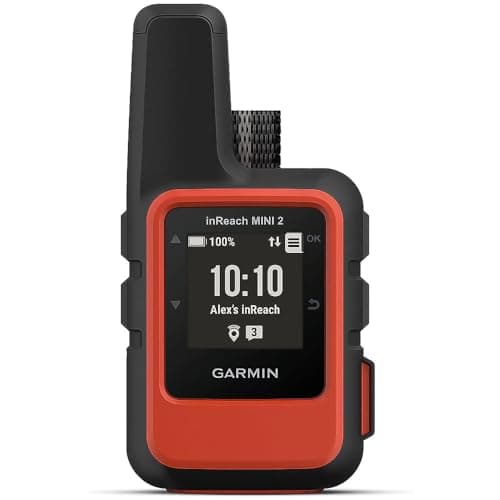
Garmin Garmin inReach Mini 2
Garmin inReach Mini 2

Garmin states global two-way messaging beyond cellular coverage, weeks on a single charge, and interactive SOS to a 24/7-staffed response center. An active plan is required, stated by Garmin — and for this job that is money well spent.

Being findable where there is no coveragePlan required

Plan for satellite

$324.00Amazon
02
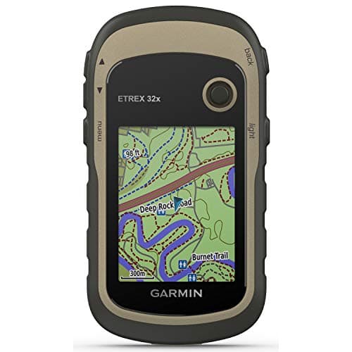
Garmin Garmin eTrex 32x
Garmin eTrex 32x

A handheld GPS on AA batteries with preloaded topographic maps and no subscription for navigation. It tells you where you are; it tells nobody else, and that distinction is the whole page.

Knowing where you are, with no feeNo monthly fee

$0 + batteries

$299.99Amazon
03
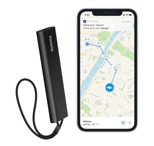
Invoxia Invoxia GPS Tracker PRO
Invoxia GPS Tracker PRO

Weeks of battery and a motion alert over a low-power cellular network — useful for gear parked where there is coverage, useless deep in the backcountry. The listing states no subscription is included.

A pack left at a trailhead or in a vehiclePlan required

Plan required

$99.00Amazon
04
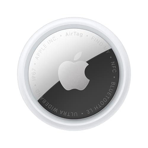
Apple Apple AirTag (2nd generation)
Apple AirTag (2nd generation)

No fee at all, and genuinely good at finding a dropped pack in a parking lot full of people. On a trail with nobody around it reports nothing, because there is no phone to hear it.

Gear, in towns and trailheadsNo monthly fee

$0 + batteries

$24.00Amazon

#ad · Live prices from Amazon's product API, as of October 22, 2026. Where we have no verified live price we show none — a gap beats a number that has rotted. Plan figures are the brands' own published rates, cited in Sources below.

In detail

The picks, in full

Garmin Garmin inReach Mini 2
$324.00View on Amazon

$399.9919% off

Price as of October 22, 2026. Prices move — Amazon's at checkout is the one that counts.

#ad · we may earn a commission from this link to Garmin inReach Mini 2

Top pickPlan required#01 · Garmin

Garmin inReach Mini 2

Being findable where there is no coverage

Garmin states global two-way messaging beyond cellular coverage, weeks on a single charge, and interactive SOS to a 24/7-staffed response center. An active plan is required, stated by Garmin — and for this job that is money well spent.

The subscription reality

The handheld works as a GPS and as a dog tracker with no fee at all. The inReach satellite messaging is the part that needs an airtime plan, and only if you want it.

Specs, as published by Garmin

  • Two-way satellite messaging and SOS via the Iridium network
  • Location sharing with no cell coverage
  • Requires an active airtime plan for messaging

Good

  • Works where no cellular tracker does, anywhere on earth
  • SOS goes to a 24/7 coordination center
  • Location sharing a family member can watch from home

Not so good

  • Airtime plan required for messaging and SOS
  • Expensive device
  • It tracks the person carrying it, not an object you lost

Skip it if

you never leave cell coverage — you are paying for satellites you will not use.

Garmin Garmin eTrex 32x
$299.99View on Amazon

Price as of October 22, 2026. Prices move — Amazon's at checkout is the one that counts.

#ad · we may earn a commission from this link to Garmin eTrex 32x

No monthly fee#02 · Garmin

Garmin eTrex 32x

Knowing where you are, with no fee

A handheld GPS on AA batteries with preloaded topographic maps and no subscription for navigation. It tells you where you are; it tells nobody else, and that distinction is the whole page.

The subscription reality

No subscription. The only recurring cost is a CR2032 roughly once a year, which is pennies.

Over three years:
about $3 in coin cells

Specs, as published by Garmin

  • Handheld GPS receiver running on AA batteries
  • Preloaded topographic mapping
  • No subscription for navigation

Good

  • Works anywhere satellites are visible with no network at all
  • AA batteries you can buy in any shop
  • No subscription for the core function

Not so good

  • It tells YOU where you are; it does not tell anyone else
  • Not an item tracker in any sense
  • Expensive

Skip it if

you want to find a lost object — this is navigation, not tracking.

Invoxia Invoxia GPS Tracker PRO
$99.00View on Amazon

Price as of October 22, 2026. Prices move — Amazon's at checkout is the one that counts.

#ad · we may earn a commission from this link to Invoxia GPS Tracker PRO

Plan required#03 · Invoxia

Invoxia GPS Tracker PRO

A pack left at a trailhead or in a vehicle

Weeks of battery and a motion alert over a low-power cellular network — useful for gear parked where there is coverage, useless deep in the backcountry. The listing states no subscription is included.

The subscription reality

Invoxia's own listing is explicit that no subscription is included with this version — a plan is a separate purchase. Treat that as a warning on the box rather than a selling point.

Specs, as published by Invoxia

  • Low-power network tracker with a long stated battery life
  • Designed for bikes, motorcycles and vans
  • Motion and tow alerts

Good

  • Battery life measured in weeks, not days
  • Good at the one job it exists for: telling you something moved that should not have
  • Well-made hardware

Not so good

  • No subscription included on this version, so the plan is an extra line on the bill
  • Low-power networks update less often than 4G
  • Expensive device

Skip it if

you want second-by-second tracking. This reports periodically; it is an alarm with a map, not a live feed.

Apple Apple AirTag (2nd generation)
$24.00View on Amazon

$29.0017% off

Price as of October 22, 2026. Prices move — Amazon's at checkout is the one that counts.

#ad · we may earn a commission from this link to Apple AirTag (2nd generation)

No monthly fee#04 · Apple

Apple AirTag (2nd generation)

Gear, in towns and trailheads

No fee at all, and genuinely good at finding a dropped pack in a parking lot full of people. On a trail with nobody around it reports nothing, because there is no phone to hear it.

The subscription reality

No subscription. The only recurring cost is a CR2032 roughly once a year, which is pennies.

Over three years:
about $3 in coin cells

Specs, as published by Apple

  • User-replaceable CR2032 coin cell; Apple states it runs more than a year
  • IP67 (1 m for up to 30 minutes, IEC 60529)
  • Ultra Wideband Precision Finding, 1.5x the range of the first generation
  • Speaker 50% louder than the first generation

Good

  • No subscription, and Apple has never charged one
  • The Find My network is the largest crowd network in the world, so a lost AirTag in a populated area usually reports within minutes
  • Precision Finding walks you to it by distance and direction, not just a map pin
  • Battery is a coin cell from any supermarket, not a sealed pack

Not so good

  • iPhone only for setup and full use — there is no Android app
  • It has no GPS of its own: it reports when an Apple device walks past it, so it is a finder, not a tracker
  • No keyring hole, so you are buying a holder as well

Skip it if

you are on Android, or you need to watch something move in real time — an AirTag only knows where it was when someone last walked past it.

The recommendation, by how you hike

Solo, remote, or out for multiple days: a satellite messenger with an active plan. Nothing else gets a message out. Share the tracking link with somebody at home and tell them your intended route and return time.

Day hikes on popular trails with coverage: your phone, with offline maps downloaded, a battery bank, and somebody who knows your plan. Spending on hardware here is optional; telling a person where you are going is not.

You want a no-fee device and navigation is the real need: a handheld GPS on AA batteries. Honest, durable, no subscription, and the thing a lot of people in this search were looking for.

Your worry is the car at the trailhead or the pack in the hostel: no-fee tags, and a cellular tracker on the vehicle if it is worth it. Those are property problems in populated places, which is the one environment where tags are strong.

What a plan actually buys on a messenger

Three things, and it is worth separating them. Two-way messaging, so you can tell somebody you are late rather than leaving them to guess. Tracked position sharing, so a watcher at home sees breadcrumbs on a map. And the SOS button, which Garmin states goes to a 24/7-staffed response center that coordinates with local services. The third is the one you are really paying for, and it is the one that has no cheaper substitute.

The legal footnote nobody mentions

Garmin notes on its own site that some jurisdictions regulate or prohibit satellite communication devices, and that following applicable law is the user's responsibility. That matters if you travel internationally with a messenger. Check the rules for your destination before you fly with one, the same way you would check whether a tracker works where you are going.

Why we do not recommend a cellular tracker for the hiker

Not because the hardware is bad — the same devices are our picks for vehicles and trailers, where they are excellent. It is that the failure mode is exactly wrong for this use. A tracker on your pack reports faithfully right up to the point the signal stops, then shows a confident pin at the last place it had bars. Somebody at home reading that map believes they know where you are. A device that is silent is safer than a device that is confidently stale. The same failure, in the pet version.

Things that matter more than the device

A trip plan left with a person, including your route and when to worry. A charged phone with offline maps. Spare batteries kept warm in an inside pocket, because cold cuts capacity hard. And testing the messenger at home — send a message, share a track, make somebody confirm they can see it — rather than discovering on day three that the plan was never activated.

If you buy one device and want it to do the most

Buy the messenger. It navigates adequately through your phone, it shares your position, it sends messages, and it has the SOS. The handheld GPS is the better map, the tag is better at finding gear, and neither of those is the thing that gets you off a mountain. Everywhere else on this site we would tell you to avoid the subscription; here it is the product.
How we picked

We did not lab-test these trackers

Everyone in this category claims to have tested twenty devices. We have not tested any of them, and we say so on every page. What we did instead: read each manufacturer's published specifications and cite them with the date, find the actual subscription price and cite that too, and work out what thirty-six months of ownership costs at those published figures. Device prices come live from Amazon's API and expire after 48 hours rather than going stale. Where a figure could not be sourced to the manufacturer, the page says the spec is unconfirmed rather than borrowing it from a competitor's review. The full method is on the methodology page.

Working out what a tracker really costs? See the three-year cost of every tracker, compared.

Questions

Frequently asked

Is a GPS tracker or a satellite messenger better for hiking?
A satellite messenger, if the point is that somebody can find you or you can call for help. Garmin states that inReach devices give global two-way messaging beyond cellular coverage plus interactive SOS to a 24/7-staffed response center, and that an active plan is required. A cellular GPS tracker needs a carrier signal to report, so in the backcountry it shows the last place it had bars — which is worse than silence, because it looks current.
Is there a GPS tracker for hiking with no monthly fee?
There are no-fee devices, but none of them do the job people usually mean. A handheld GPS receiver on AA batteries navigates with no subscription and transmits nothing. A Bluetooth tag has no fee and only reports when a stranger's phone passes it, which on a trail is never. Anything that reports your position from outside coverage uses satellites, and satellites are what the subscription pays for.
Will an AirTag work for hiking?
For gear in populated places, yes — a trailhead parking lot, a shuttle van, a hostel, a town resupply. An AirTag has no GPS and no SIM, so it reports only when a participating phone hears it, and on a trail there are no phones. Use tags on a pack, a tent bag or keys left in a car, and never as the device that would find a person.
Does an inReach need a subscription?
Yes. Garmin states on its own site that handhelds with inReach technology require an active plan, which is what pays for the satellite airtime behind messaging, position sharing and SOS. Confirm current plan tiers with Garmin for your region before buying, and ask whether you can suspend the plan out of season — for a hiker who is out for part of the year, that is the single biggest saving available.
Can my phone do satellite SOS instead?
Possibly, depending on the handset, the carrier and the country — several recent phones offer a form of emergency satellite messaging, and where it exists it is a real safety net. Check your own device's documentation rather than assuming, and treat it as a backstop rather than a plan: it is not the same as two-way messaging and tracked position sharing on a multi-day trip, and a phone battery is a worse bet than a dedicated device that Garmin rates for weeks on a charge.

Read next

Where the figures came from

Sources

Every specification and plan price on this page traces to one of these, read on the date shown. Device prices are live from Amazon and stamped separately.

  1. Garmin — inReach satellite communicators: "global two-way messaging" beyond cellular coverage, "weeks on a single charge", "interactive SOS messages with your GPS coordinates to the 24/7-staffed Garmin Response center", and the stated requirement "Handhelds with inReach technology: Active plan required" plus the note that some jurisdictions regulate or prohibit satellite communication devices — accessed 2026-10-20
  2. Apple — AirTag product page (battery, IP67, Precision Finding) — accessed 2026-10-05
  3. Amazon Product Advertising / Creators API — live prices and product images — accessed 2026-10-05